Thursday, July 17, 2008


Star Plots: Allows the comparison of multiple data units for each group. The variable frequencies for each group are plotted as radii from the center.

Correlation Matrix: Shows any correlation between any pairs of data sets.


Similarity Matrix: any group of data units plotted on the x and y planes with points marked where any two data units are similar.

Stem and Leaf Plot: The numbers in the column to the left of the bar are the stem and are added to the numbers in the columns to the right of the bar to complete the data.
Box Plot: boxplots can be used to display differences between populations without making any assumptions about the underlying statistical distribution.


Histogram: A graph that uses vertical or horizontal columns to display the frequency of some variable.


Parallel Coordinate Graph: Each variable is graphed on a vertical axis. A data element is plotted as a connected set of points, one on each axis. It can be used to explore relationships among variables.

Triangular Plot: Each side of an equalateral triangle is an x, y, or z plane on which three variables are plotted showing the interaction of the variables.


Windrose: A circular plot showing the frequencies of wind from each direction during a given time period.

Climograph: A graphic representation of the correlation between temperature and precipation during a given year.

Thursday, July 10, 2008


Population Profile: Also called a Population Pyramid, it may take the form of a graph composed of horizontal groups of bars showing the quantities or percentages of people of both sexes at each age group.

Scatter plot: A scattered group of points are plotted that show a relationship between two variables. Regression analysis can be used to show a trend line that is characteristic of the values plotted.

Index value Plot: The changing variables are plotted against an index value which may be any given variable during a given year or a zero value and the variables plotted plus or minus relative to that index value.

Accumulative line Graph or Lorenz Curve: A graph for showing the concentration of economic quantities such as wealth and income. It is formed by plotting the cumulative distribution of the amount of the variable concerned against the cumulative frequency distribution of the individuals possessing the amount.


Bilateral Graph: Two related variables that both use the same x and y planes are plotted on the same graph for comparison. It may also be a graph that shows increases of a variable on one side of a graph line and decreases on the other side.

Saturday, July 5, 2008


Nominal Area Chorlpleth Map: qualitative, categorical, classification into groups without any ordering.

Unstandardized Choropleth Map: The data used in making the map is just the total data and not areally averaged.

Standardized Choropleth Map: A choropleth map that has been areally averaged. The information is not just a total value (e.g. number of people in a state ) but standardized to some unit, usually area (e.g. people per square mile).

Univariate Choropleth Map: A choropleth map in which only one variable is illustrated.


Bivariate Choropleth Map: A choropleth map in which two variables are distinquished. In this case, Democrat and Republican.

Friday, July 4, 2008


Unclassed Choropleth Map: A choropleth map in which the data is continuous. There are as many intervals as there are areal units.


Classed Choropleth Map: The data is grouped within areas such as states and counties, shaded according to value. Areal units are combined into a smaller number of units classified as intervals. There are typically four to seven units of classification. Units may be classified according to equal steps, natural breaks, minimum variance, or quantile.

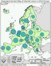
Range Graded Proportional Circle Map: Range graded proportional circle map: a proportional circle map that depicts the data in relation to ranges of data. The information is classified as equal quantiles, breaks, natural breaks, and minimum variance. . Range-graded scaling: The data are divided into groups, using classification procedures common to choropleth mapping. The design goal is for symbol size discrimination, rather than magnitude estimation. The cartographer chooses symbol sizes for adjacent classes so that the map reader can easily distinguish between circle sizes, and therefore, categories. Only a set number of circle sizes are used.

Monday, June 30, 2008

Continuously Variable Proportional Circle Map: A proportional circle map using circles that are in proportion to the variable being measured.

Digital Orthophoto Quarter Quadrangle (DOQQ): A digital raster (pixel based ) image of an aerial photograph in which displacements caused by the camera and terrain have been removed through orthorectification. It combines the image qualities of a photograph with the geometric qualities of a map. A DOQ is either B&W or color infrared (CIR) and represents one USGS 7.5 minute quadrangle. A DOQQ is one quarter of the quadrangle, so the DOQ name is followed by SE, NE, SW, or NW. DOQQ scale is 1:12,000 or 1" = 1,000' .


Digital Elevation Model (DEM): A representation of the Earth's surface stored in a digital file containing regularly spaced point locations with an elevation attribute. It can also use shading to represent hieghts.

Digital Line Graph : A digital version of the USGS Topographic Quad maps. They contain vector line representations of cartographic map features and attribute codes. They are organized by scale and thematic content.

Friday, June 27, 2008


DRG Map: Digital Raster Graphic map, a scanned image of a USGS topographic map that has been georeferenced to the earth's surface and referenced to a UTM projection.


Isopleth Map: The lines drawn on the map connect points that have equal amounts of some variable such as sunshine (isohel). This one shows how the map is constructed.


Isopach Map: The lines drawn on the map connect points of equal thickness of rock strata.


Isohyet Map: A map consisting of lines drawn connecting points of equal rainfall.

Tuesday, June 24, 2008


Isotach Map: Lines on a weather connect points of equal wind speed.


Isobar Map: Lines on a weather map connecting points of equal air pressure.


LIDAR Map: Light Detection and Ranging, also called Lasar Radar it is a method of detecting distant objects and determining their position, velocity, or other characteristics by analysis of pulsed laser light reflected from their surfaces. It is useful for creating accurate DEMs.

Google Earth Satellite Image: This is an image taken from a satellite of Glascow.

Saturday, June 21, 2008


Doppler Radar Map: This uses the Doppler effect to show patterns of suspended and moveing precipitation particles.


Black and White Aerial Photo: An aerial photo taken in black and white only.


Infrared Aerial Photo: Infrared EM waves have a wavelength in the range of c. 75 x 10,000,000 to c. 100,000 x 10,000,000. Roughly between visible light and radio wavelengths. This is a heat image of a forest.

Wednesday, June 18, 2008


Cartographic Animation: The use of GIS and computer databases to create animated, changeable, interactive maps. This can include temporal animations, generalization animations (e.g. change of births), geographic trend animations (e.g. census data), and classification animations. This one shows the dates of African independence.


Statistical Map: A map in which the variation in the quantity of a factor such as rainfall, population, or crops in an area is indicated. A dot map is one type. In a statistical map each unit is represented by a shading or color that represents the value or range of values for that variable. The statistics shown on the map can express rates, ratios, percentages or other statistical measures. Values in the distribution must be mutually exclusive and exhaustive. This one is for a mining operation.


Cartogram: a cartogram is broadly defined as a map using statistical symbols. It is also defined as a type of map transformation based on a scale other than a true scale. This one supposedly shows countries by population size.

Wednesday, June 11, 2008


Flow Map: Similar to a network map but with line width varied to show value. A network map is a set of connected lines with similar values.

Isoline Map: A presentation of statistical data in geographical distribution. Data classified and grouped within areas such as states and counties, sahded according to value. The lines represent continuous levels of some value.


Proportionnal Circle Map: point data measured with a circle instead of a dot. The area of each circle is proportional to the statistical data represented for any given region of the map. This one is from the 2006 Canada census.


Chloropleth Map: A map that uses graded differences in shading or color or the placing of symbols in defined areas on the map in order to indicate the average values of some property or quantity in those areas. This one is a map of hay distribution in these united states.

Tuesday, June 10, 2008


Dot Distribution Map: It uses the quantity of dots to represent the location and concentration of something. A greater density of dots represents a greater concentration. Dots do not vary in size but may be differentiated by shapes or colors. This one is of the distribution of a type of fungus.

Propaganda map: In this case it was used to illustrate the danger of nuclear missles in Cuba. Propaganda is a concerted set of messages aimed at influencing the behaviors or opinions of large numbers of people. It uses disinformation or the selective presentation of information to create a false and usually emotionally manipulative mental map.


Hypsometric map: A 3-D representation of a surface with relief. It represents the elevation with color and the area between contour lines, shaping and raised relief.

Thursday, June 5, 2008


Cadastral Map: a legal map that describes boundaries and ownership. This one is of Fairfax county and was made up of 30 layers of data.


Thematic Map: It displays a spatial distribution of an attribute that relates to a theme. In this case it is a distribution of population in the United States.